


"Byron" has arrived: Following an evening of lightning, thunder, and intense rainfall and primarily in the north and along the coast. Precipitation expected to intensify throughout Tuesday.
Video: Flooding in southern Israel / Eilot Regional Council
The storm will strengthen gradually. Rains that began overnight will intensify in the north and reach the central region by Tuesday night. On Wednesday, high-intensity rainfall is expected, raising serious concerns for flooding along the coast and in the Shefela (lowlands).
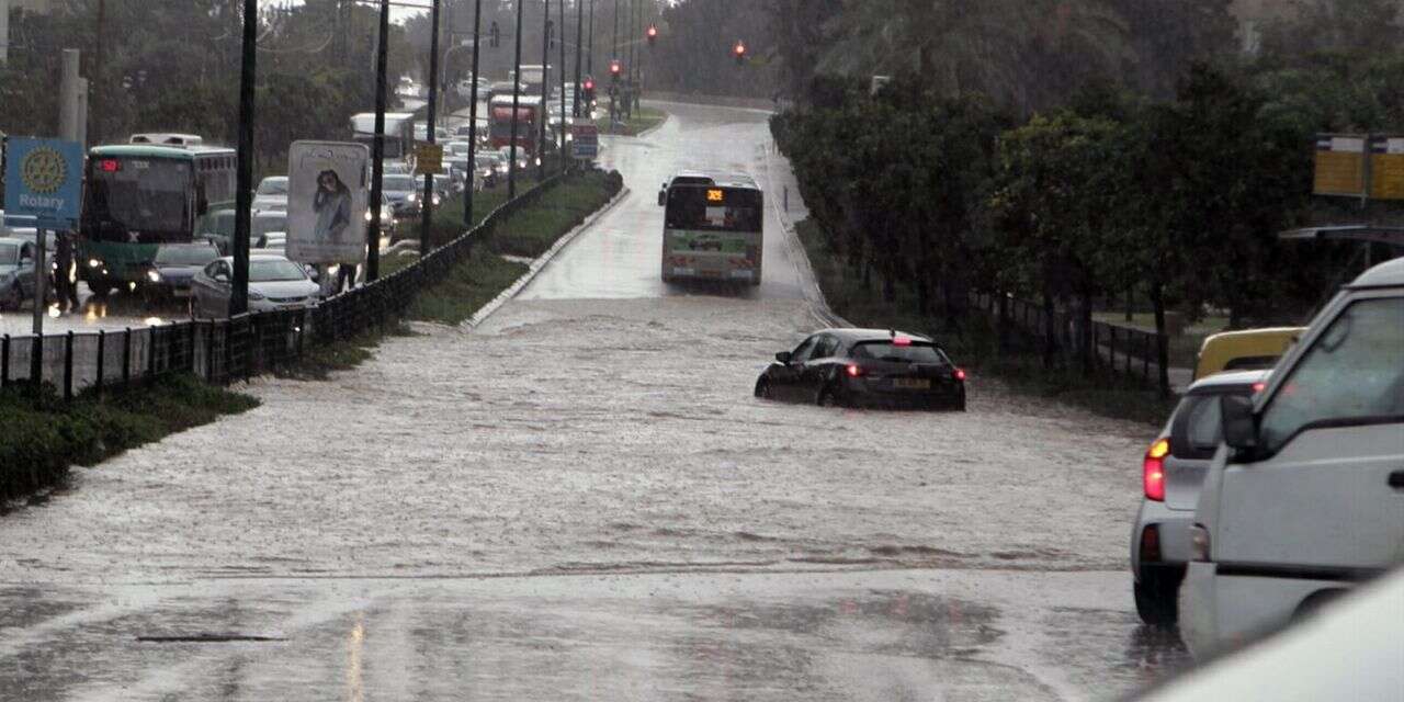
The system will peak between Wednesday night and Thursday, delivering tens of millimeters of rain within hours. The forecast warns of gale-force winds reaching 80–100 km/h (50–62 mph), urban flooding, disruptions to daily life, and flash floods in the streams of the Judean Desert and the Dead Sea area. Rain will persist into Friday, focusing primarily on central Israel.
Officials at the Israel Meteorological Service emphasize that "Byron" is expected to bring "abnormal" precipitation levels and exceeding 200 millimeters (nearly 8 inches) in areas of the northern coast, Gush Dan (Tel Aviv metropolitan area), and the southern coast. These figures surpass the average rainfall for the entire month of December.
The extended forecast
On Tuesday, skies will be partly cloudy to cloudy. Local showers and isolated thunderstorms are expected along the coastal plain, particularly in the north. Local rain is possible in the mountains during the afternoon. Temperatures will remain average for the season, but the Mediterranean Sea will see high waves and is considered very dangerous for swimming.
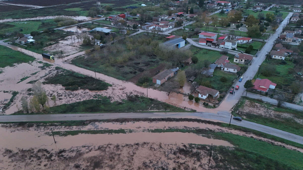
On Wednesday, showers accompanied by thunderstorms will sweep through northern and central Israel. There is a severe risk of flooding in the coastal plain and the Shefela (lowlands). Brisk winds will blow, primarily along the coast and in the mountains. Rain will gradually spread to the Negev, creating a risk of flash floods in the Judean Desert streams and the Dead Sea area.
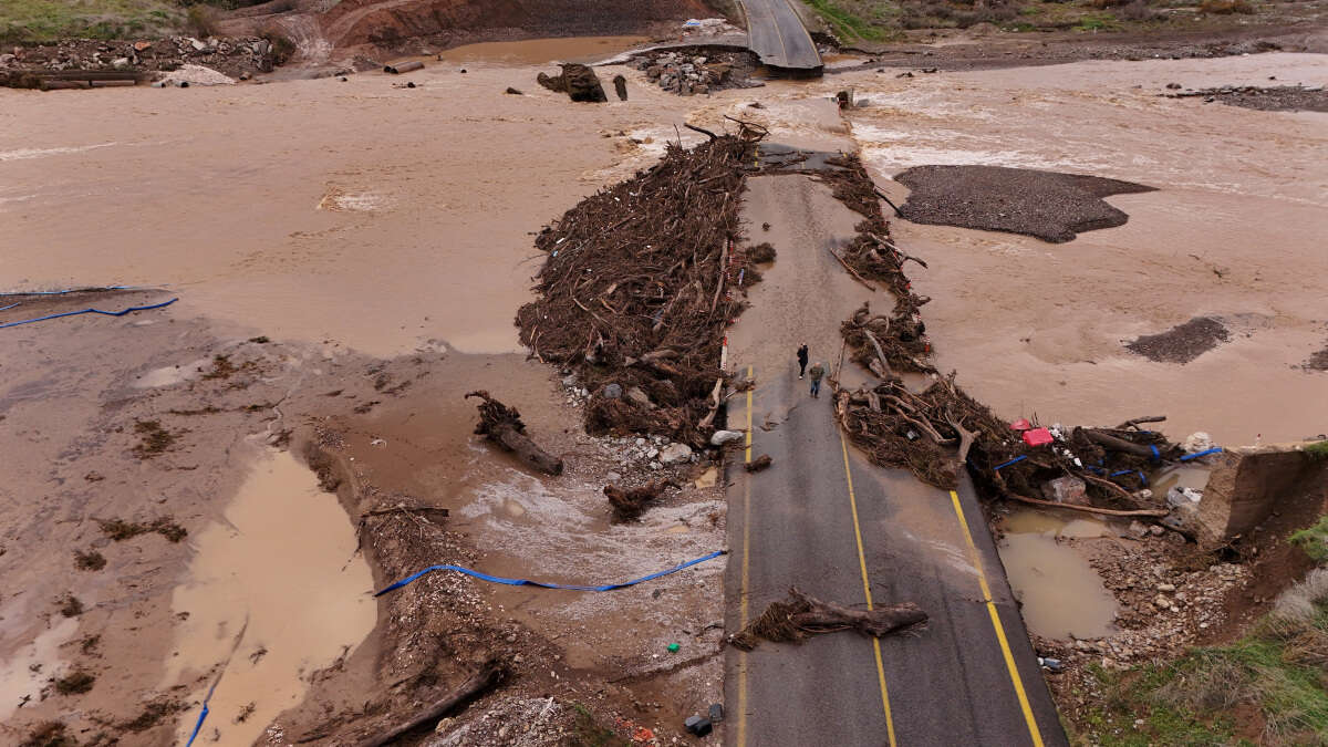
On Thursday, rain accompanied by isolated thunderstorms will fall from the north to the northern Negev. Local rain is possible in the southern Negev. Flash flood warnings remain in effect for the Judean Desert, the Dead Sea, and the northern Arava (desert valley). Flooding risks persist for the coastal plain and the Shefela (lowlands). Brisk winds will continue, and temperatures will drop below the seasonal average.
On Friday, the weather will remain cloudy to partly cloudy. Local rains will continue from the north to the northern Negev, with isolated thunderstorms possible until noon. Local flooding risks remain for the coastal plain, as well as flash flood warnings for the Judean Desert and Dead Sea streams. Temperatures will rise slightly but will remain unseasonably cool, particularly in the mountains and inland area


