


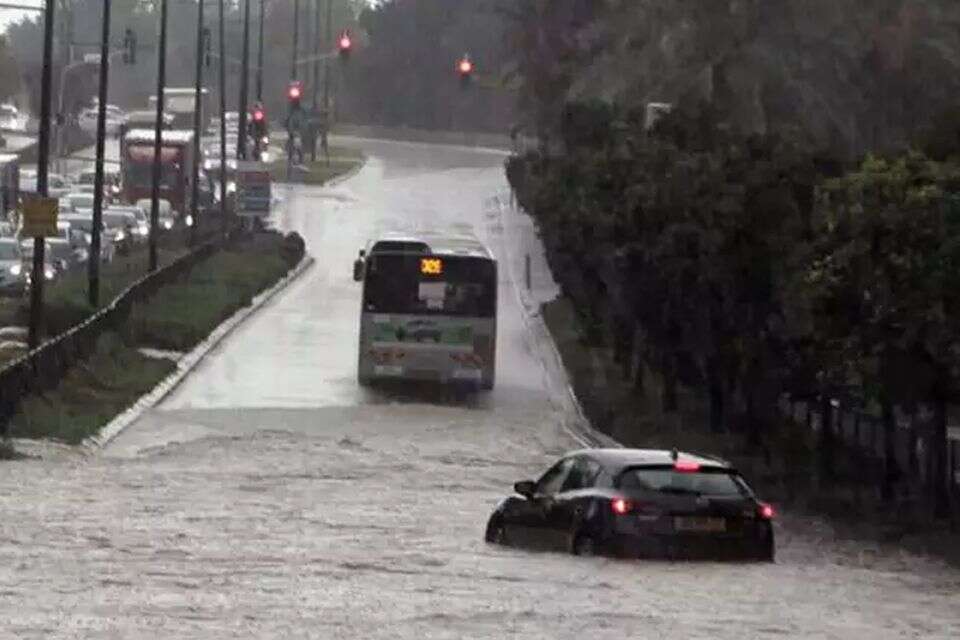
After a heavy rainstorm swept across Israel on Tuesday, authorities are bracing for another significant weather system expected in the coming days, with particular concern focused on central Israel. Forecasts warn that if extreme scenarios materialize, there is a real risk of widespread flooding and flash floods, especially along the central and southern coastal plain.
Rain is expected to resume as early as Saturday morning, with precipitation forecast for northern and central parts of the country. At the same time, the gradual drop in temperatures that began on Friday is expected to continue.
A marked escalation is forecast for Sunday. The first half of the day is expected to be very rainy, with intense downpours, isolated thunderstorms and a heightened risk of flooding in the central and southern coastal areas, the central highlands, Samaria and the Jerusalem hills. Flash floods are also expected in the Judean Desert, along Dead Sea wadis and as far south as the northern Negev.
Rainfall focus on central and southern Israel
According to meteorological models, the heaviest rainfall totals are expected in central Israel, including the coastal plain, the central highlands, Gush Etzion and the Hebron area, as well as parts of the Jordan Valley.
In cities such as Ashdod and Yavne, some scenarios predict unusually high cumulative rainfall of about 100 to 150 millimeters (roughly 4 to 6 inches). Similar amounts may be recorded along the central coast, the central lowlands and the central highlands, significantly increasing concerns about serious flooding.
By contrast, rainfall totals in northern Israel are expected to be lower at this stage. In the area between Netanya and Atlit and in inland parts of the north, forecasts point to about 30 to 60 millimeters (around 1 to 2.5 inches). Similar amounts are expected in Tiberias, the Golan Heights and the Kokhav HaYarden area.
In Haifa and the Carmel Ridge, forecasts are even lower, at just 10 to 30 millimeters (less than 1.2 inches). However, heavier rainfall of about 80 to 100 millimeters (3 to 4 inches) may accumulate in the Upper Galilee and around Nahariya. Forecasters note that additional rain systems are expected early next week, at least through Tuesday, which could improve overall rainfall totals in the north.
Forecast for the coming days
Wednesday: Partly cloudy to clear. The Mediterranean Sea will be calm to slightly choppy. The Sea of Galilee and the Red Sea will be calm.
Thursday: Partly cloudy to clear, with no significant change in temperatures. Strong easterly winds are expected in the northern mountains and Samaria during the morning.
Friday: Partly cloudy with a slight drop in temperatures. Light drizzle to localized light rain is possible in the north and along the coastal plain.
Saturday: Intermittent rain in the north and central regions, with a chance of isolated thunderstorms. Local rain is possible in the northern Negev. Temperatures will drop slightly again, mainly in the mountains and inland areas.
Monday and Tuesday are expected to be very cold, and the rain, as noted, may continue.


