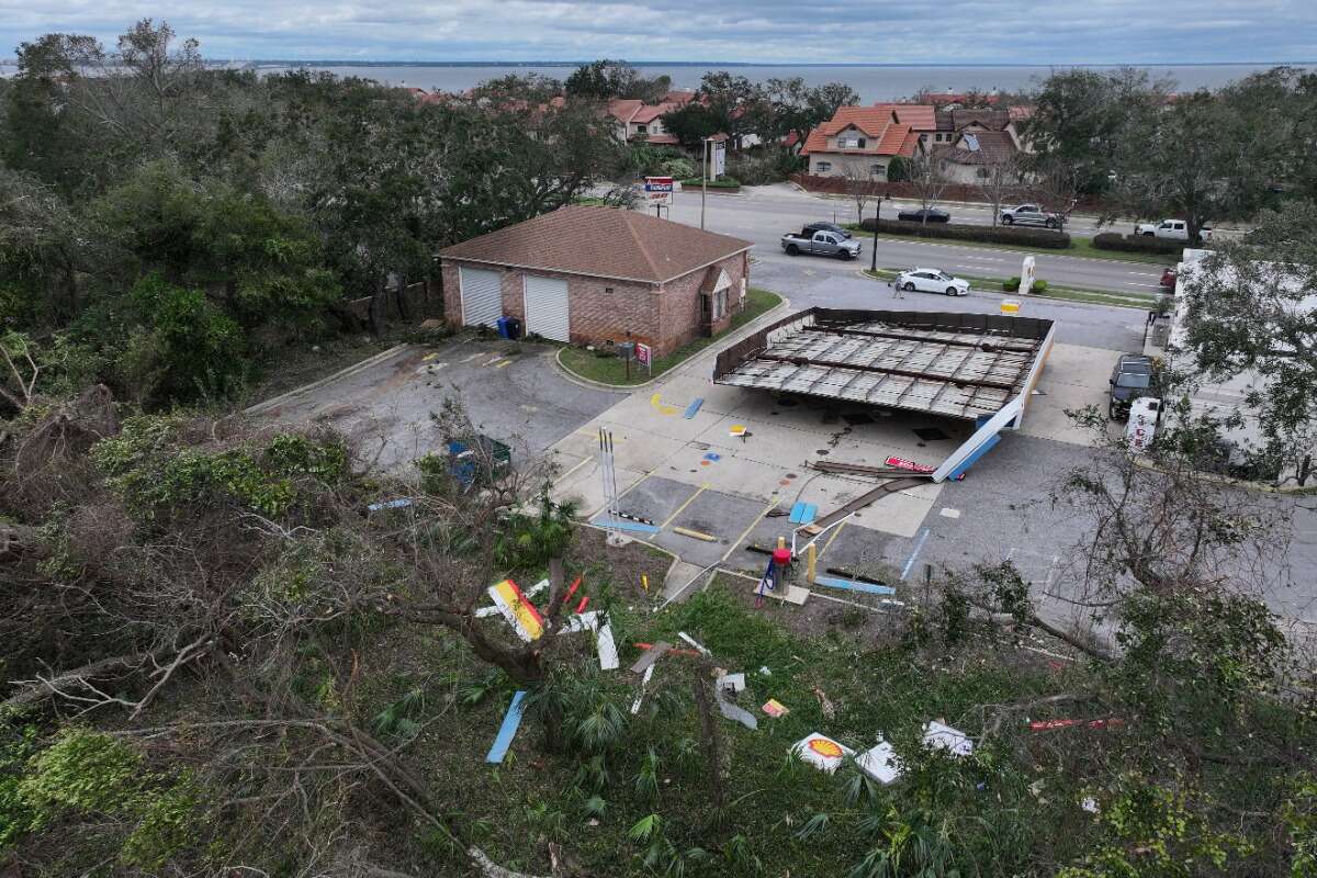
Four are dead and nearly 900,000 have lost power as Isaias struck near Destin, Florida, late Friday as a Category 2 hurricane, The Washington Post reported. Wind gusts topped 100 mph (160 km/h), and storm surge reached as high as six feet (1.8 meters). Pensacola Beach saw a peak gust of 117 mph (188 km/h), while Santa Rosa Beach recorded 116 mph (187 km/h), poweroutage.us reported, tracking outages across Georgia, Alabama and Florida.
A woman died in Escambia County when a tree fell on her home, a sheriff's office spokesperson told The Washington Post, with crews finding her unresponsive around 20:48. A man died from generator fumes in an unventilated garage, Sheriff Chip Simmons said, while a falling tree killed a third victim in Birmingham, fire chief Cory Moon said. Gov. Kay Ivey confirmed a fourth Alabama death without details.
Isaias has since weakened into a post-tropical system, with the Hurricane Center lifting its tropical alerts. It is expected to pass through Tennessee into Kentucky by Sunday, with forecasters warning of lingering flash flood and tornado risk from northeast Georgia into the Carolinas.
Gov. Ron DeSantis said crews cleared debris overnight from roads including Interstate 10, and all coastal bridges have reopened. No search-and-rescue requests had come in, he said on "Fox & Friends Weekend," calling that "cautiously a good sign." "I think that may be a sign that people heeded the warnings, took proper precautions," the governor said.
Santa Rosa County fared worse, with officials saying roads were "impassable due to down trees and/or power lines" and urging residents to avoid travel "unless absolutely necessary." In Milton, roofs were torn off buildings and a gas station awning was destroyed, DeSantis said, as crews assessed Panhandle-wide damage.
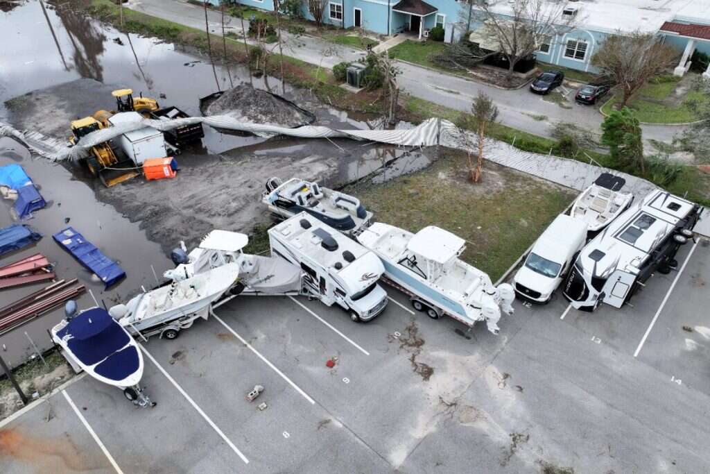
Fort Walton Beach flooding delayed cleanup after roughly 20 centimeters (8.04 inches) of rain triggered a "life-threatening flooding" emergency, the National Weather Service said. A rare extreme wind warning covered four Panhandle counties. "TAKE COVER NOW!," wrote the service's Mobile office, urging residents to "Treat these imminent extreme winds as if a tornado was approaching and move immediately to the safe room in your shelter" and to find a "reinforced interior room away from windows."
Isaias's remnants, near Montgomery, Alabama, still threatened flooding and tornadoes across the Appalachians, Carolina foothills and northeast Georgia, with six to eight inches of rain possible. South Carolina, eastern Georgia and the Mid-Atlantic also faced lingering tornado risk into Sunday.
Ahead of landfall, residents boarded homes and stacked sandbags in Destin and Pensacola, while evacuation orders covered coastal Alabama and Panhandle counties. Pensacola's airport closed and over 20 Waffle House locations shut temporarily, The Washington Post noted, after DeSantis declared emergencies across 27 Florida counties.
Utilities planned shutdowns on Pensacola Beach and Okaloosa Island against surge, with the Emerald Coast Utilities Authority set to end service once personnel evacuate. Rain is forecast into the Ohio Valley, Mid-Atlantic, Northeast and New England through Sunday, clearing Monday.
No new Atlantic storms are expected this week, though San Diego faces a watch before Rachel's Sunday arrival. Off Mexico, Hurricane Simon, now Category 4 with 150 mph (241 km/h) winds, threatens 10 to 20 inches of rain and dangerous surge by Sunday.