


The current war will be remembered as a watershed moment for the world of unmanned vehicles. If in the past a drone was perceived as a toy or a photography tool, events on the ground have proven it to be a critical component of national resilience. However, the challenge facing us is not the drone itself, but the ability to manage it in an autonomous, AI-based, safe, and continuous manner over populated areas, without human intervention and in real-time.
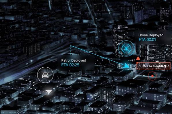
As emergency events unfold simultaneously across multiple locations, the traditional "one pilot per drone" model breaks down. During an emergency, rescue services and local authorities need eyes on the ground within seconds. In a world where the missile threat from Iran is becoming tangible, the question is not only whether the interceptors will work, but what happens in the local municipality at the moment of impact. The ability to launch an autonomous drone array within just 15 seconds from urban docking stations provides decision-makers with a critical live situational picture, even before security forces have started their vehicles.
The architectural revolution
The required technological leap is the adoption of the Drone as a First Responder (DFR) approach. Unlike the familiar model, where a drone is a support tool in the hands of an operator in the field, the DFR approach elevates the craft to the first operational tier at the scene. This is an autonomous, remotely operated array where drones stationed at strategic points launch immediately upon receipt of a report at the command center.
This means eliminating the "fog of urban war." The drone reaches the site of impact or fire before rescue forces have even set out, streaming information that allows for understanding of the damage intensity and resource prioritization. When a DFR drone operates autonomously, it transforms from a flying camera into a smart edge sensor connected to Artificial Intelligence. It is capable of performing advanced analytics during flight, analyzing findings, and transmitting a dynamic situational picture—all without endangering operators under the threat of missiles or collapsing buildings. The municipalities of Holon and Modi'in demonstrated this advantage when they were the first to document a missile impact site in real time, providing an image that enabled precise management of the evacuation scene.

The Numbers behind the surge
Data supports this trend. Recent research reports predict annual growth of over 15% in the aerial autonomy and DFR solutions market, driven by the need for urban resilience. Simultaneously, studies by the U.S. Federal Aviation Administration (FAA) and international emergency bodies indicate that the use of autonomous drone swarms shortens the time to locate casualties and assess damage by 30% to 50% compared to traditional scanning methods.
Fascinating examples of implementation exist worldwide: In China, autonomous drone networks are used to monitor traffic congestion and identify hazards in smart cities. In Brazil, a highway monitoring project uses drones as first responders to identify accidents, enabling shorter evacuation times and improved safety. In the U.S., DFR programs have already shown that drones arrive at an incident scene in an average of less than 2 minutes, providing critical information to police officers before their physical arrival.
Israel as a global field lab
Israel has a historic opportunity to lead the global market, not only in manufacturing physical vehicles but in developing the "autonomous brain" that manages them. The operational experience gained here is unique: the ability to operate autonomous systems under electronic GPS jamming, extreme weather conditions, and some of the strictest aviation regulations in the world. Following the success in Holon, we are witnessing an expanding trend: additional cities have already begun training and operating independent drone fleets, granting mayors full control from anywhere with ease.
Projects like Israel's "National Drone Initiative" have already proven the feasibility of delivering medical equipment and securing critical infrastructure (such as refineries and ports) via a managed aerial network. Local authorities currently investing in a "civilian aerial dome" to secure border-seam areas are discovering that the autonomous drone is, in fact, a budgetary and operational force multiplier. It eliminates the need for expensive vehicle patrols and provides a perimeter response that physical fences can never offer.
From technological courage to regulatory courage
For this vision to become a national standard, we must accelerate the adoption of regulations enabling large-scale autonomous flights over populated areas. The technology exists and is accessible, the operational maturity has been proven in "blood and fire," and what is now required is the managerial courage to adopt autonomy as an integral part of the urban and national security concept.
In a world where threats become dynamic and arrive from the air, the response must come from the same space—smarter, faster, and completely autonomous. The skies above Israel's cities must become a managed, digital space, not only for technological innovation but also for the preservation of security and human life.
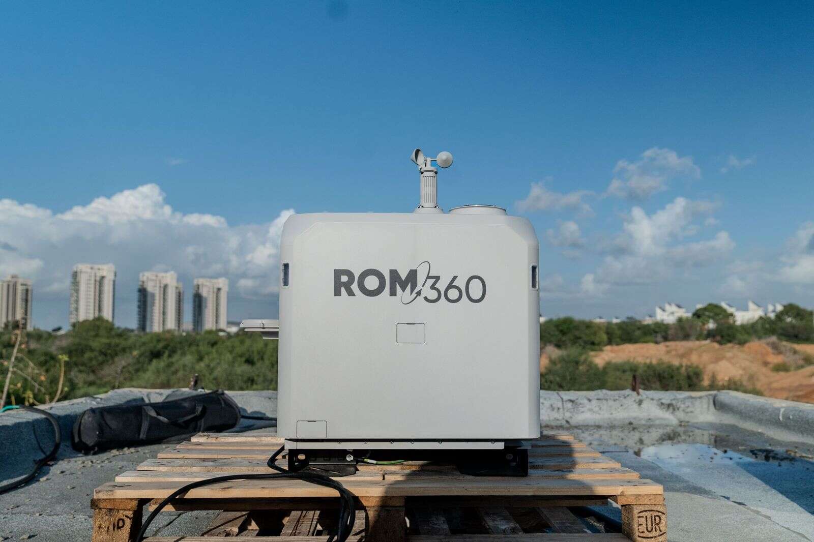
Yoely Or is the Founder and CEO of Cando and leads the ROM360 array in collaboration with the global company High Lander.


